


Regional Planning Commission 8--New Orleans City (South) PUMA, Louisiana
About
Outline
+PUMA%2c+Louisiana_A280.png)
Summary
| Unique Area Identifier | 193019 |
| Name | Regional Planning Commission 8--New Orleans City (South) PUMA |
| State | Louisiana |
| Area (square miles) | 32.16 |
| Land Area (square miles) | 26.30 |
| Water Area (square miles) | 5.86 |
| % of Land Area | 81.79 |
| % of Water Area | 18.21 |
| Latitude of the Internal Point | 29.92296110 |
| Longtitude of the Internal Point | -90.02063490 |
Maps
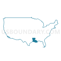
+PUMA in Louisiana.png)
Graphs
Select a template below for downloading or customizing gragh for Regional Planning Commission 8--New Orleans City (South) PUMA, Louisiana
+PUMA%2c+Louisiana_T0.png)
+PUMA%2c+Louisiana_T1.png)
+PUMA%2c+Louisiana_T2.png)
+PUMA%2c+Louisiana_T3.png)
+PUMA%2c+Louisiana_T4.png)
+PUMA%2c+Louisiana_T5.png)
+PUMA%2c+Louisiana_T6.png)
+PUMA%2c+Louisiana_T7.png)
+PUMA%2c+Louisiana.png)
Neighbors
Neighoring Public Use Microdata Area (by Name) Neighboring Public Use Microdata Area on the Map
- Regional Planning Commission 5--Jefferson Parish (West Bank) PUMA, LA
- Regional Planning Commission 6--New Orleans City (Northeast) PUMA, LA
- Regional Planning Commission 7--New Orleans City (Central) PUMA, LA
- Regional Planning Commission 9--St. Bernard, Jefferson (South) & Plaquemines Parishes PUMA, LA
Top 10 Neighboring County (by Population) Neighboring County on the Map
- Jefferson Parish, LA (432,552)
- Orleans Parish, LA (343,829)
- St. Bernard Parish, LA (35,897)
- Plaquemines Parish, LA (23,042)
Top 10 Neighboring County Subdivision (by Population) Neighboring County Subdivision on the Map
- New Orleans city, Orleans Parish, LA (343,829)
- District 1, Jefferson Parish, LA (92,049)
- District 2, Jefferson Parish, LA (81,272)
- District E, St. Bernard Parish, LA (7,972)
- District D, St. Bernard Parish, LA (7,955)
- District C, St. Bernard Parish, LA (7,360)
- District B, St. Bernard Parish, LA (6,958)
- District A, St. Bernard Parish, LA (5,652)
- District 2, Plaquemines Parish, LA (4,036)
- District 1, Plaquemines Parish, LA (1,943)
Top 10 Neighboring Place (by Population) Neighboring Place on the Map
- New Orleans city, LA (343,829)
- Marrero CDP, LA (33,141)
- Terrytown CDP, LA (23,319)
- Harvey CDP, LA (20,348)
- Gretna city, LA (17,736)
- Chalmette CDP, LA (16,751)
- Belle Chasse CDP, LA (12,679)
- Westwego city, LA (8,534)
- Bridge City CDP, LA (7,706)
- Meraux CDP, LA (5,816)
Top 10 Neighboring Unified School District (by Population) Neighboring Unified School District on the Map
- Jefferson Parish School District, LA (432,552)
- Orleans Parish School District, LA (343,829)
- St. Bernard Parish School District, LA (35,897)
- Plaquemines Parish School District, LA (23,042)
Top 10 Neighboring State Legislative District Lower Chamber (by Population) Neighboring State Legislative District Lower Chamber on the Map
- State House District 85, LA (43,859)
- State House District 86, LA (40,627)
- State House District 82, LA (39,989)
- State House District 83, LA (38,305)
- State House District 105, LA (37,438)
- State House District 87, LA (36,307)
- State House District 102, LA (35,477)
- State House District 95, LA (34,279)
- State House District 93, LA (30,550)
- State House District 98, LA (30,348)
Top 10 Neighboring State Legislative District Upper Chamber (by Population) Neighboring State Legislative District Upper Chamber on the Map
- State Senate District 6, LA (137,299)
- State Senate District 8, LA (113,097)
- State Senate District 7, LA (110,828)
- State Senate District 1, LA (89,479)
- State Senate District 5, LA (82,088)
- State Senate District 3, LA (79,418)
- State Senate District 4, LA (71,484)
- State Senate District 2, LA (65,868)
Top 10 Neighboring 111th Congressional District (by Population) Neighboring 111th Congressional District on the Map
- Congressional District 1, LA (686,961)
- Congressional District 3, LA (637,371)
- Congressional District 2, LA (493,352)
Top 10 Neighboring Census Tract (by Population) Neighboring Census Tract on the Map
- Census Tract 502, Plaquemines Parish, LA (8,262)
- Census Tract 250.01, Jefferson Parish, LA (7,589)
- Census Tract 6.16, Orleans Parish, LA (4,712)
- Census Tract 282, Jefferson Parish, LA (4,505)
- Census Tract 6.06, Orleans Parish, LA (4,346)
- Census Tract 6.17, Orleans Parish, LA (4,334)
- Census Tract 301.03, St. Bernard Parish, LA (4,138)
- Census Tract 6.15, Orleans Parish, LA (4,014)
- Census Tract 6.11, Orleans Parish, LA (4,010)
- Census Tract 6.04, Orleans Parish, LA (3,925)
Top 10 Neighboring 5-Digit ZIP Code Tabulation Area (by Population) Neighboring 5-Digit ZIP Code Tabulation Area on the Map
- 70072, LA (56,344)
- 70058, LA (39,887)
- 70056, LA (39,082)
- 70118, LA (33,008)
- 70115, LA (31,695)
- 70094, LA (31,669)
- 70131, LA (29,915)
- 70126, LA (23,958)
- 70117, LA (23,389)
- 70114, LA (22,870)